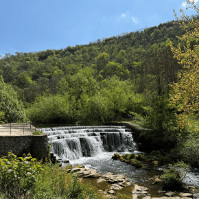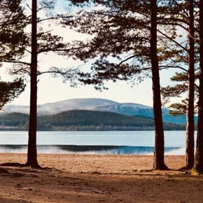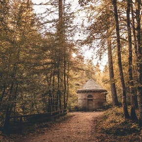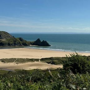

Two dogs and UK map

Ultimate UK dog walks

Top 5 dog walks

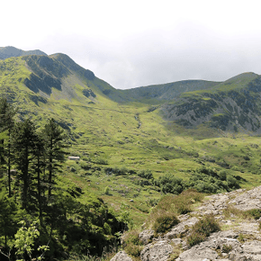
Rydal Water Circular

Rydal Water Circular

Ambleside Lake District

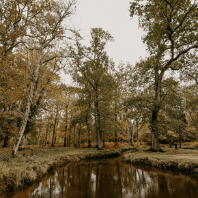
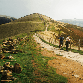
Bolderwood Radnor Trail - 2

Bolderwood Radnor Trail

New Forest National Park, Hampshire

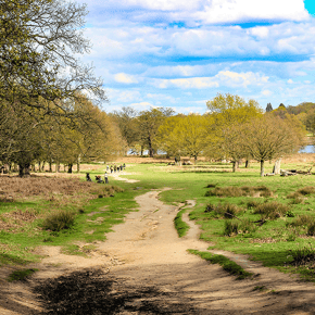
Baggy Point Circular Walk - 3

Baggy Point Circular

North Devon

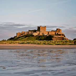
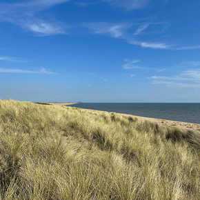
Bamburgh Beach Circular Walk - 4

Bamburgh Beach Circular

Northumberland

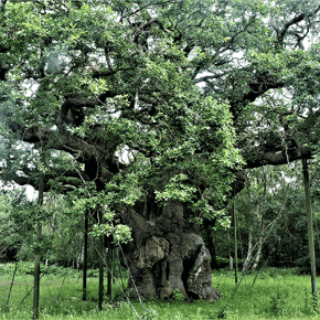
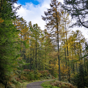
Major Oak Trail - 5

Major Oak Trail

Sherwood Forest, Nottinghamshire


Whether you're planning a summer adventure, searching for somewhere new to explore or simply looking to make your next walk that little bit more memorable, Ultimate UK Dog Walks from Animal Friends is here to help.

From sweeping beaches and woodland trails to mountain lakes, riverside strolls and historic landscapes, we've brought together some of the UK's favourite dog-friendly walking routes to inspire your next day out together.

20 of these walks were ranked by UK dog owners themselves, with research from July 2026* exploring what people value most when choosing where to walk their dogs. From spectacular scenery and open space to opportunities for sniffing, swimming and exploring, each featured route reflects the places owners believe make for a truly memorable walk. And if 20 walks aren’t enough for you, we’ve added a few extra bonus walks for good measure!

Ultimate UK Dog Walks makes it easier to discover safe, enriching and genuinely dog-friendly places to explore. Whether you're staying close to home or planning your next adventure, we hope it inspires many memorable days out with your four-legged friend.
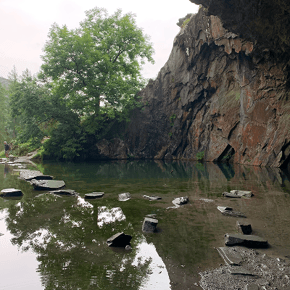
 

Rydal Water Circular Dog Walk
1

Rydal Cave & Loughrigg Fell Circular

Ambleside, Lake District

Combining two of the Lake District’s most iconic dog-friendly highlights, Loughrigg Fell and Rydal Cave, this circular route showcases the area’s standout scenery in one rewarding walk. From views across Grasmere from Loughrigg Terrace to the summit of Loughrigg Fell, the historic cave above Rydal Water and the lakeside return route, it offers an exceptional mix of adventure, variety and enrichment for active dogs and confident walkers.

Region:
North West England
Location:
Ambleside Lake District
Postcode:
LA22 9SE
Coordinates:
54.450100, -3.006693

Start / End Point:
White Moss Car Park
Distance:
3.85 miles

Duration:
Approx. 2 hours 20 minutes
Difficulty:
Hard

Accessibility:
This route is not suitable for wheelchair or pushchair users due to uneven woodland paths, rocky sections around Rydal Cave, exposed fell terrain, steep ascents and descents, and technical sections requiring good fitness, sure-footedness and sturdy footware.

Parking:
White Moss car park (pay and display).

Fees / charges:
Parking charges may apply.  Check local parking tariffs before travelling.

Facilities:

  • Public toilets nearby
  • Cafes nearby; check individual dog-griendly policies before visiting
  • Pubs in Ambeside; check individual dog-friendly policies before visiting

Dog-Friendly Features:

  • Lake access
  • Woodland exploration
  • Fell walking
  • Open countryside
  • Panoramic viewpoints
  • Varied terrain and scent enrichment opportunities

Dog Guidance:
Dogs are welcome throughout the route and should be kept under close control at all times.  Use a lead around livestock, wildlife, open water, roads, steep drops, rocky ground, busy viewpoints and wherever local signage asks for it.  Given the route is rated hard and includes more demanding terrain owners should consider their dog's fitness and confidence before setting off.

Suggested Route:

  • Start at White Moss car park.
  • Follow the route towards Loughrigg Terrace, kaing in elevated views of Grasmere.
  • Continue the climb towards Loughrigg Fell summit, where there are panoramic views across the surrounding Lake District landscape.
  • Descend from the summit towards the rydal cave section, taking care on uneven and rocky ground.
  • Spend time at Rydal Cave, remaining mindful of slippery rocks and steep drops around the cave area.
  • Continue towards the viewpoints over Rydal Water and the lakeside return route.
  • Follow the path along Rydal Water, keeping dogs under close control around open water and other walkers.
  • Rejoin the return paths towards White Moss.
  • Finish back at White Moss car park.

Things to be mindful of:

  • Hard-rated route requiring good fitness, sure-footedness and sturdy footwear
  • Sustained climbs and descents, with 280m/ approx. 925ft of ascent and descent across the route
  • Technical, difficult or azardous terrain on some sections
  • Steep and uneven sections on Loughrigg Fell
  • Rocky terrain around Rydal Cave
  • Grazing livestock
  • Open water around Rydal Water
  • Muddy and slippery surfaces after rainfall
  • Blue-green algae can occasionally occur in lakes during warmer weather.  Follow local signage and avoid allowing dogs to enter water that appears discoloured or has visible surface scum.

What to pack:
Pack water for you and your dog, a collapsible bown, dog waste bags, snacks and treats, a towel for muddy paws, weather-appropriate layers, sturdy footwear and a lead suitable for livestock, wildlife and busy sections.

Countryside Code reminder:
Follow local signs, keep dogs under close control, use a lead around livestock, wildlife, roads, steep drops and crowded areas, clean up after your dog and leave gates and paths as you found them.

what3words ref: richer.snowmen.birthing  

 
Bolderwood
2

Bolderwood Radnor Trail

New Forest National Park, Hampshire

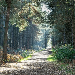
A peaceful woodland route offering space to roam and some of the New Forest's most iconic scenery.

Region:
South East England
Location:
New Forest National Park, Hampshire 
Postcode:
SO43 7GE  
Coordinates:
50.856700, -1.639700

Start / End Point:
Bolderwood Car Park
Distance:
1.9 miles

Duration:
Approx. 1 hour
Difficulty:
Easy

Accessibility:
This route is partially suitable for wheelchair and pushchair users, with generally smooth forest paths and a small number of slopes.

Parking:
Bolderwood car park.

Fees / charges:
Parking charges may apply.  Check local parking tariffs before travelling.

Facilities:

  • Public toilets
  • Picnic areas 
  • Visitor information point 

Dog-Friendly Features:

  • Woodland trails
  • Open forest
  • Wildlife scents 
  • Stream access 


Dog Guidance:
Dogs are welcome throughout the route and should be kept under close control at all times. Use a lead around ponies, deer, livestock, wildlife areas, roads, busy visitor areas and wherever local signage asks for it.

Suggested Route:

  • Start at Bolderwood car park and head to the information point and trailhead area.
  • Look for the red waymarked posts for the Radnor Trail.
  • Follow the red markers away from the car park and into the woodland.
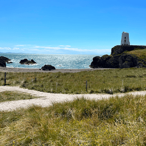
  • Continue through ancient and ornamental woodland, passing areas of sweet chestnut, oak and beech.
  • Follow the trail as it skirts the edge of Mark Ash Wood.
  • Continue down towards Bratley Water, a stream section that makes a natural rest point.
  • Stay with the red waymarkers as the path loops back through woodland.
  • Towards the end of the walk, follow the trail past the deer viewing platform.
  • Continue on the circular trail until it returns to Bolderwood car park. 

Things to be mindful of:

  • Free-roaming ponies 
  • Deer
  • Wet woodland surfaces after rainfall 
  • Road crossings

What to pack:
Pack water for you and your dog, a collapsible bowl, dog waste bags, snacks and treats, a towel for muddy paws, weather-appropriate layers, sturdy footwear and a lead suitable for livestock, wildlife and busy sections.

Countryside Code reminder:
Follow local signs, stay on marked paths, keep dogs under close control around ponies, deer, livestock and other visitors, clean up after your dog and leave gates and paths as you found them.

What3words ref: hatch.zooms.suspends

 
Baggy Point
3

Baggy Point Circular

North Devon

A manageable coastal adventure that captures everything people love about the South West Coast Path. With panoramic ocean views, spectacular cliffs and open countryside, it offers one of Devon's most rewarding dog-friendly walks.

Region:
South West England
Location:
North Devon
Postcode:
EX33 1PA  
Coordinates:
51.142506, -4.259470

Start / End Point:
Baggy Point Car Park
Distance:
2.8 miles

Duration:
Approx. 1.5 hours
Difficulty:
Easy-Moderate

Accessibility:
This route is not suitable for wheelchair or pushchair users due to uneven coastal footpaths, grazing land, steep sections and exposed cliff-top terrain, with some sections becoming slippery in wet weather.

Parking:
National Trust Baggy Point car park.

Fees / charges:
National Trust parking charges may apply; National Trust members may park free where valid. Check current tariffs before travelling.

Facilities:

  • Public toilets
  • Café nearby; check individual dog-friendly policies before visiting
  • National Trust facilities; dog access may vary, so check site rules before visiting
  • Nearby village amenities in Croyde; dog access may vary, so check individual policies before visiting
  • Picnic areas 

Dog-Friendly Features:

  • Coastal scent trails
  • Open grassland
  • Clifftop paths
  • Sea views
  • Wildlife spotting opportunities 


Dog Guidance:
Dogs are welcome throughout the route and should be kept under close control at all times. Use a lead around livestock, grazing areas, cliff edges, nesting wildlife, busy sections and wherever local signage asks for it.

Suggested Route:

  • Start at Baggy Point car park.
  • Leave the car park by the kiosk and tu right up the asphalted lane, following signs for Baggy Point. 
  • Continue along the lane, taking care where traffic may be present.
  • Follow the route towards the headland, enjoying views over Croyde Bay.
  • Continue around Baggy Point, staying on the marked coastal path.
  • Follow the path around the headland, taking care near cliff edges.
  • Begin the inland section over the top of the headland.
  • Follow the circular route back across farmland and open countryside.
  • Rejoin the main route towards the car park.
  • Return to Baggy Point car park. 

Things to be mindful of:

  • Steep cliff edges
  • Grazing livestock
  • Uneven coastal paths
  • Strong coastal winds
  • Slippery surfaces after rainfall
  • Exposed sections with little shelter 

What to pack:
Pack water for you and your dog, a collapsible bowl, dog waste bags, snacks and treats, a towel for muddy paws, weather-appropriate layers, sturdy footwear and a lead suitable for livestock, wildlife and busy sections.

Countryside Code reminder:
Follow local signs, keep dogs on lead around livestock and cliff edges, stay on marked paths, leave gates as found, clean up after your dog and take care not to disturb wildlife or grazing animals.

What3words ref: kneeled.mashing.assurance

 
Bamburgh Beach Walk
4

Bamburgh Beach & Dunes Circular

Northumberland, North East England

Few walks combine history, scenery and open coastal space quite like Bamburgh. With miles of beach, dramatic castle views and plenty of room to explore, it offers one of the UK's most memorable dog walking experiences.  

What to expect:
Expansive beaches, rolling dunes and breathtaking views of Bamburgh Castle.

Region:
North East England
Location:
Northumberland
Postcode:
NE69 7DF
Coordinates:
 55.607277, -1.709912  

Start / End Point:
Links Road Car Park, Bamburgh
Distance:
4 miles

Duration:
Around. 2 hours
Difficulty:
Easy

This route has limited access for wheelchair or pushchair users, as it includes beach sand and dune terrain which can be difficult for wheelchairs, pushchairs and visitors with reduced mobility; firmer sand may be accessible at low tide, but conditions vary throughout the year.

Parking:
Links Road car park, Bamburgh.

Fees / charges:
Parking charges may apply. Nearby attractions may charge separate entry fees, so check before visiting.

Facilities:

  • Public toilets
  • Cafés nearby; check individual dog-friendly policies before visiting
  • Restaurants nearby; check individual dog-friendly policies before visiting
  • Village amenities; dog access may vary, so check individual policies before visiting
  • Shops nearby; dog access may vary, so check individual policies before visiting
  • Beach access

Dog-Friendly Features:

  • Expansive sandy beach
  • Open space for off-lead exercise
  • Dune exploration
  • Coastal scenery
  • Year-round dog-friendly beach

Dog Guidance:
Dogs are welcome throughout the route and should be kept under close control at all times. Use a lead around nesting birds, dunes, wildlife-sensitive areas, busy beach sections, village areas and wherever local signage asks for it.

Suggested Route:

  1. Start at Links Road Car Park.
  2. Head through the dunes towards Bamburgh Beach.
  3. Walk along the beach with views of Bamburgh Castle.
  4. Continue along the sand, keeping the castle and dunes as orientation points.
  5. When ready to loop back, turn inland through the dune paths.
  6. Follow the dune paths above the shoreline and towards the village side of Bamburgh.
  7. Continue on the paths behind the dunes, keeping close to the coast.
  8. Return to Links Road Car Park.

Things to be mindful of:

  • Tides and changing beach conditions
  • Wildlife and nesting birds
  • Strong coastal winds
  • Soft sand can be tiring
  • Dune erosion areas
  • Busy beach periods during summer

What to pack:
Pack water for you and your dog, a collapsible bowl, dog waste bags, snacks and treats, a towel for muddy paws, weather-appropriate layers, sturdy footwear and a lead suitable for livestock, wildlife and busy sections.

Countryside Code reminder:
Check tide times and local signage, keep dogs under close control around nesting birds, dunes and other visitors, clean up after your dog and avoid disturbing wildlife or fragile habitats. 

what3words ref:  insert.condition.poems  

 
Major Oak
5

Major Oak Trail

Sherwood Forest, Nottinghamshire

A chance to walk through one of Britain's most famous forests and discover the legendary Major Oak. Rich in history, wildlife and natural beauty, this route offers a quintessential woodland adventure with plenty of opportunities for dogs to explore and sniff their way through one of England's most iconic landscapes.

What to expect:
Ancient woodland, legendary oak trees and well-maintained forest trails.

Region:
East Midlands
Location:
Sherwood Forest, Nottinghamshire
Postcode:
NG21 9RN
Coordinates:
 53.198150, -1.067235 

Start / End Point:
Sherwood Forest Visitor Centre
Distance:
1.5 miles

Duration:
Around 45 minutes
Difficulty:
Easy

Wheelchair and pushchair access:
This route is partially accessible for wheelchair and pushchair users, with well-maintained woodland paths on one of Sherwood Forest’s more accessible routes, though some sections may become muddy after wet weather and path surfaces vary throughout the forest.

Parking:
Sherwood Forest Visitor Centre car park.

Fees / charges:
Parking charges may apply at the visitor centre. Some visitor centre facilities, events or nearby attractions may have separate charges, so check before travelling.

Facilities:

  • Public toilets
  • Visitor centre; dog access to indoor areas may vary, so check site rules before visiting
  • Café nearby; check individual dog-friendly policies before visiting
  • Gift shop; dog access to indoor areas may vary, so check site rules before visiting
  • Picnic areas
  • Visitor information point
  • Family facilities; dog access may vary, so check site rules before visiting

Dog-Friendly Features:

  • Ancient woodland
  • Shaded walking routes
  • Wide forest paths
  • Natural scent trails
  • Short, manageable distance
  • Year-round walking

Dog Guidance:
Dogs are welcome throughout Richmond Park and should be kept under close control at all times. Use a lead around deer, wildlife, cyclists, runners, horse riders, busy areas and wherever park signage asks for it, including seasonal deer-sensitive periods.

Suggested Route:

  1. Start at Sherwood Forest Visitor Centre.
  2. Follow signs and waymarkers for the Major Oak Trail.
  3. Continue along the main forest path through ancient woodland.
  4. Pass beneath mature oak trees and enjoy the peaceful forest setting.
  5. Follow the trail as it winds through the heart of Sherwood Forest.
  6. Reach the Major Oak, the forest's most famous landmark and a highlight of the walk.
  7. Continue beyond the Major Oak following the signed circular route.
  8. Loop back through woodland paths, passing additional ancient trees and open glades.
  9. Follow signs back towards the Visitor Centre.
  10. Return to Sherwood Forest Visitor Centre.

Things to be mindful of:

  • Busy visitor numbers during weekends and holidays
  • Muddy paths after rainfall
  • Shared use with walkers and families
  • Protected woodland environment
  • Tree roots and uneven ground in places
  • Seasonal events that can increase footfall

What to pack:
Pack water for you and your dog, a collapsible bowl, dog waste bags, snacks and treats, a towel for muddy paws, weather-appropriate layers, sturdy footwear and a lead suitable for livestock, wildlife and busy sections.

Countryside Code reminder:
Follow forest signage, keep dogs under close control around ancient trees, wildlife, families and other walkers, stay on marked paths, clean up after your dog and avoid disturbing protected woodland habitats. 

what3words ref:  permit.glimmers.wells  

 
Richmond Park
6

Tamsin Trail

Richmond Park, London

A rare chance to enjoy a truly immersive countryside-style walk without leaving the capital. The route showcases the best of Richmond Park, combining huge open spaces, ancient woodland, wildlife encounters and some of London's most impressive natural scenery.

What to expect:
Open parkland, ancient trees, wildlife and panoramic views across London's largest Royal Park.

Region:
London
Location:
Richmond Park, London
Postcode:
BT33 0PW
Coordinates:
 51.438800, -0.290000  

Start / End Point:
Pembroke Lodge
Distance:
7.3 miles

Duration:
Around. 2.5-3 hours
Difficulty:
Moderate

Wheelchair and pushchair access:
The route is partially accessible to wheelchair and pushchair users, with wide, well-maintained paths around much of Richmond Park, though the full route is lengthy and includes some inclines, uneven surfaces and shared-use sections.

Parking:
Pembroke Lodge car park.

Fees / charges:
Parking charges may apply in or around Richmond Park. Check current Royal Parks parking information and local restrictions before travelling.

Facilities:

  • Public toilets
  • Café nearby; check individual dog-friendly policies before visiting
  • Refreshment kiosks across the park; check individual dog-friendly policies before visiting
  • Café nearby; check individual dog-friendly policies before visiting
  • Visitor information
  • Drinking water points
  • Multiple park entrance

Dog-Friendly Features:

  • Extensive open parkland
  • Woodland trails
  • Natural scent trails
  • Streams and ponds nearby
  • One of London's largest green spaces
  • Opportunities for long-distance walking

Dog Guidance:
Dogs are welcome throughout Richmond Park and should be kept under close control at all times. Use a lead around deer, wildlife, cyclists, runners, horse riders, busy areas and wherever park signage asks for it, including seasonal deer-sensitive periods.

Suggested Route:

  1. Start at Pembroke Lodge.
  2. Join the Tamsin Trail, the perimeter route around Richmond Park.
  3. Follow the track away from Pembroke Lodge, keeping to the signed trail.
  4. Continue around the park boundary, passing open grassland and woodland sections.
  5. Follow the trail towards the Ham and Kingston side of the park.
  6. Continue around towards Robin Hood Gate and Roehampton Gate.
  7. Stay on the Tamsin Trail as it passes near Beverley Brook and Adam's Pond.
  8. Follow the trail onwards towards Sheen Gate and Richmond Gate.
  9. Continue the final section back towards Pembroke Lodge.
  10. Finish where you began at Pembroke Lodge.

Things to be mindful of:

  • Free-roaming deer throughout the park
  • Shared-use paths with cyclists and runners
  • Long route distance
  • Exposed sections during hot weather
  • Busy visitor periods at weekends and holidays
  • Seasonal deer rutting and calving periods

What to pack:
Pack water for you and your dog, a collapsible bowl, dog waste bags, snacks and treats, a towel for muddy paws, weather-appropriate layers, sturdy footwear and a lead suitable for livestock, wildlife and busy sections.

Countryside Code reminder:
Follow park signage, keep dogs under close control around deer, wildlife, cyclists and families, clean up after your dog and give other visitors plenty of space. 

what3words ref:  probe.frames.gains  

 
Holkham
7

Holkham Beach & Pinewoods Circular

Norfolk, East of England

One of the UK's most spectacular dog-friendly beaches, offering freedom, space and endless opportunities to explore.  

What to expect:
Vast stretches of sand, pine forests, dunes and uninterrupted coastal views.

Region:
East of England
Location:
Norfolk
Postcode:
NR23 1RG
Coordinates:
 52.960382, 0.814812  

Start / End Point:
Lady Anne's Drive Car Park
Distance:
4-5 miles

Duration:
1 hour 45 mins–2 hours
Difficulty:
Easy

Wheelchair and pushchair access:
This route is partially suitable for wheelchair and pushchair users, with boardwalk sections available in places, though beach sand, dunes and uneven coastal terrain may present challenges.

Parking:
Lady Anne's Drive car park..

Fees / charges:
Parking charges may apply. Check local parking tariffs before travelling.

Facilities:

  • Public toilets
  • Café nearby; check individual dog-friendly policies before visiting
  • Picnic areas
  • Beach access
  • Visitor information nearby

Dog-Friendly Features:

  • Year-round beach access
  • Open space for exercise
  • Dunes and woodland trails
  • Water access
  • Plenty of opportunities for scent exploration

Dog Guidance:
Dogs are welcome throughout the route and should be kept under close control at all times. Use a lead around nesting birds, dunes, wildlife-sensitive areas, busy beach sections and wherever local signage asks for it, particularly during seasonal restriction periods.

Suggested Route:

  1. Start at Lady Anne’s Drive car park.
  2. Follow the main beach access route towards Holkham Beach, passing through the dunes.
  3. Once on the beach, turn and follow the sands along the coast, keeping the sea to one side and the dunes/pinewoods behind.
  4. Continue along the beach section, choosing firmer sand where possible.
  5. After enjoying the open beach, turn inland towards the pinewoods.
  6. Follow the woodland path through the trees, using the pinewood route to begin looping back.
  7. Continue through the pinewoods until the route brings you back towards Lady Anne’s Drive.
  8. Return to the car park.

Things to be mindful of:

  • Tides and changing beach conditions
  • Soft sand can be tiring for both dogs and owners
  • Seasonal restrictions to protect nesting birds
  • Exposure to sun and wind in warmer months
  • Limited shade on the beach section

What to pack:
Pack water for you and your dog, a collapsible bowl, dog waste bags, snacks and treats, a towel for muddy paws, weather-appropriate layers, sturdy footwear and a lead suitable for livestock, wildlife and busy sections.

Countryside Code reminder:
Check tide times and local signs before setting off, keep dogs under close control around nesting birds and other beach users, clean up after your dog and take all litter home.

what3words ref:  expect.ironclad.lamps 

 
Cwm
8

Cwm Idwal Circular

Eryri (Snowdonia), Wales

An accessible taste of Eryri's spectacular mountain environment without tackling a major summit. The combination of crystal-clear waters, towering mountain walls and rugged scenery makes it one of the most rewarding short walks in Wales.

What to expect: Mountain scenery, glacial lakes and dramatic Welsh landscapes.

Region:
Wales
Location:
Eryri (Snowdonia), Wales  
Postcode:
LL57 3LZ
Coordinates:
53.123294, -4.020563  

Start / End Point:
Ogwen Visitor Area  
Distance:
3.1 miles

Duration:
Around. 3.1 hours
Difficulty:
Moderate

Accessibility:
This route is not suitable for wheelchair and pushchair users due to rough mountain paths, uneven rocky surfaces, exposed sections, loose stone and steep gradients.  

Parking:
Ogwen Visitor Area / Ogwen Cottage parking area .

Fees / charges:
Parking charges may apply at the Ogwen Visitor Area / Ogwen Cottage parking area. Check current tariffs and any seasonal parking arrangements before travelling .

Facilities:

  • Visitor information
  • Public transport links
  • Seasonal refreshments nearby; check individual dog-friendly policies before visiting
  • Access to wider Eryri walking network

Dog-Friendly Features:

  • Lake access
  • Mountain scenery
  • Open countryside
  • Natural scent trails
  • Diverse terrain
  • Quiet walking environment outside peak periods

Dog guidance: Dogs are welcome throughout the route and should be kept under close control at all times. Use a lead around livestock, protected habitats, open water, exposed sections, rough mountain paths and wherever National Trust or local signage asks for it.  

Suggested Route:

  1. Start at Ogwen Cottage / Ranger Base.
  2. Walk west for a short distance and cross the bridge towards the Cwn Idwal Visitor Centre building.
  3. Follow the clear path into the national Nature Reserve.
  4. Continue uphill on the rough mountain path towards Llyn Idwal.
  5. When the lake comes into view, join the lakeside path.
  6. Follow the circular route around Llyn Idwal.
  7. Continue beneath the dramatic cliffs and rock formations around the cwm.
  8. Stay on the main circular lakeside path and avoid higher climbing routes unless intentionally extending the walk.
  9. Cross the stream and bridge section as the path completes the lake loop.
  10. Retrace the approach path downhill towards Ogwen.
  11. Finish back at Ogwen Cottage / Visitor Centre area

Things to be mindful of:

  • Rapidly changing mountain weather
  • Uneven and rocky terrain
  • Exposed sections around the lake
  • Livestockand protected habitats
  • Slippery rocks after rainfall
  • Strong winds in por weather conditions
  • Limited shelter once on the main route

What to pack:
Pack water for you and your dog, a collapsible bowl, dog waste bags, snacks and treats, a towel for muddy paws, weather-appropriate layers, sturdy footwear and a lead suitable for livestock, wildlife and busy sections.

Countryside Code reminder:
Follow mountain and National Trust signage, keep dogs on lead around livestock, protected habitats, open water and exposed sections, clean up after your dog and check weather conditions before setting off.  

what3words ref: removers.works.remodel

 
Mam
9

Mam Tor Circular

Castleton, Peak District

A classic Peak District adventure delivering huge views and rewarding walking terrain. From the dramatic limestone walls of Cave Dale to the panoramic views from Mam Tor and the Great Ridge, it offers one of the most memorable walking experiences in the National Park.

What to expect: Rolling hills, ridge walks and some of the Peak District's most famous viewpoints.

Region:
East Midlands
Location:
Castleton, Peak District
Postcode:
S33 8WN
Coordinates:
53.343292, -1.777707  

Start / End Point:
Castleton Visitor Centre
Distance:
5 miles

Duration:
Around. 2-3 hours
Difficulty:
Moderate

Accessibility:
This route is not suitable for wheelchair and pushchair users due to steep climbs, uneven hill paths, rocky terrain, limestone sections through Cave Dale and exposed ridge walking.  

Parking:
Castleton Visitor Centre car park or nearby public parking in Castleton village .

Fees / charges:
Parking charges may apply at Castleton Visitor Centre, nearby public car parks or National Trust Mam Nick car park. National Trust members may park free where valid. Check current tariffs before travelling.

Facilities:

  • Public toilets
  • Cafés nearby; check individual dog-friendly policies before visiting
  • Pubs nearby; check individual dog-friendly policies before visiting
  • Picnic areas nearby at Old Station Tintern
  • Visitor information
  • Convenience sotres nearby; dog access may vary, so check individual policies before visiting
  • Pinic areas nearby
  • Water refill points in Castleton

Dog-Friendly Features:

  • Open countryside
  • Ridge-top walking
  • Natural scent trails
  • Expansive views
  • Woodland and valley sections
  • Opportunities for longer adventures

Dog guidance: Dogs are welcome throughout the route and should be kept under close control at all times. Use a lead around livestock, roads, steep ridge sections, Cave Dale, exposed paths, busy sections and wherever local signage asks for it, especially during lambing season.  

Suggested Route:

  1. Start at Castleton Visitor Centre.
  2. Walk to the main road and turn left towards the village.
  3. At The Bull's Head, turn right onto Castle Street, signposted towards Peveril Castle.
  4. Continue past the village green and market cross.
  5. Look for the public bridleway sign for Cave Dale between houses.
  6. Follow the Bridleway into Cave Dale.
  7. Continue uphill through the limestone gorge, staying on the main path.
  8. Continue towards the summit path and climb to Mam Tor trig point.
  9. From the summit, follow the ridge path along the Great Ridge.
  10. Continue towards the descent route back in the direction of Castleton.
  11. Follow signed paths and tracks downhill back towards Castleton.
  12. Return through village lanes to Castleton Visitor Centre.
  13. Finish where you began at Castelton Visitor Centre.

Things to be mindful of:

  • Steep ascents and descents
  • Sheep and grazing livestock
  • Exposed ridge paths
  • Strong winds on the summit
  • Slippery limestone after rain
  • uneven and rocky terrain
  • Limited shade on higher sections during warm weather

What to pack:
Pack water for you and your dog, a collapsible bowl, dog waste bags, snacks and treats, a towel for muddy paws, weather-appropriate layers, sturdy footwear and a lead suitable for livestock, wildlife and busy sections.

Countryside Code reminder:
Follow local signs, keep dogs on lead around livestock, roads, steep ridge sections and Cave Dale, leave gates as found, clean up after your dog and be prepared for exposed hilltop weather.

what3words ref: streetcar.void.steps

 
Ridding Wood
10

Ridding Wood Trail

Grizedale Forest, Cumbria

A gentle introduction to the Lake District's forests with plenty of opportunities for sniffing and discovery. Combining accessible woodland trails, beautiful scenery and interactive sculpture installations, it's a relaxed walk that both dogs and owners can enjoy at their own pace.  

What to expect: Woodland exploration, forest sculptures and family-friendly trails.

Region:
North West England
Location:
Grizedale Forest Cumbria
Postcode:
LA22 0QJ
Coordinates:
54.340573, -3.023445  

Start / End Point:
Grizedale Visitor Centre  
Distance:
1 mile

Duration:
Around. 30-45 mintutes
Difficulty:
Easy

Accessibility:
The route is fully accessible for wheelchair and pushchair users, following wide, surfaced paths suitable for a broad range of visitors and designed as an easy-access woodland walk.  

Parking:
Grizedale Visitor Centre car park.  

Fees / charges:
Parking charges may apply at Grizedale Visitor Centre. Some visitor centre facilities, bike hire or forest activities may charge separately, so check current tariffs before travelling.

Facilities:

  • Public toilets
  • Cafés nearby; check individual dog-friendly policies before visiting
  • Visitor centre; dog access may vary, so check site rules before visiting
  • Picnic areas
  • Cycle hire; check site rules before visiting
  • Play areas; dogs may need to stay outside or remain on lead nearby, so check site rules before visiting
  • Visitor information point

Dog-Friendly Features:

  • Woodland trails
  • Forest scents and enrichment oportunities
  • Streamside sections
  • Shaded walking routes
  • Sculpure trail
  • Shor, manageable route for dogs of all ages

Dog guidance:
Dogs are welcome throughout the route and should be kept under close control at all times. Use a lead around the visitor centre, cyclists, families, wildlife, streamside sections, busy forest areas and wherever local signage asks for it.

Suggested Route:

  1. Start at Grizedale Visitor Centre car park.
  2. Look for the Ridding Wood Trail signage and blue route markers.
  3. Follow the surfaced path into the oak woodland.
  4. Continue through the forest beneath mature trees, taking in views of the surrounding woodland.
  5. Follow the trail as it passes several forest sculpure installations hidden amoungst the trees.
  6. Continue alongside the stream setion that runs through the woodland.
  7. Stay on the marked route as it gently loops back through the forest.
  8. Follow the blue markers back towards the visitor centre.
  9. Return to Grizedale Visitor Centre.

Things to be mindful of:

  • Shared use with walkers and cyclists in the wider forest
  • Stream and watercourse sections
  • Potential muddy patches after heavy rainfall
  • Busy visitor periods during weekends and school holidays
  • Forestry operations in other areas of the forest

What to pack:
Pack water for you and your dog, a collapsible bowl, dog waste bags, snacks and treats, a towel for muddy paws, weather-appropriate layers, sturdy footwear and a lead suitable for livestock, wildlife and busy sections.  

Countryside Code reminder:
Follow local signage, keep dogs under close control around cyclists, families, wildlife and watercourses, stay on marked paths, clean up after your dog and take all litter home.  

what3words: commander.gazes.snap

 
Hampstead
11

Hampstead Heath Circular

Hampsted Heath London

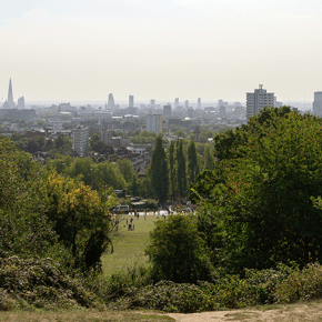
A varied urban escape offering dogs plenty of stimulation while remaining easily accessible. With woodland, open heathland, water features and panoramic city views, it delivers an impressive variety of experiences within one of London's most iconic green spaces.

What to expect: Woodland trails, ponds, open meadows and some of London's best skyline views.

Region:
London
Location:
Hampstead Heath, London
Postcode:
NW5 1QR
Coordinates:
51.560300, -0.160700  

Start / End Point:
Parliament Hill
Distance:
3 miles

Duration:
Around. 1-1.5 hours
Difficulty:
Easy

Accessibility:
This route is partially accessible for wheelchair and pushchair users, with some surfaced paths and accessible routes available throughout the Heath, though sections of the route include uneven ground, gradients, woodland trails and muddy surfaces after rainfall.  

Parking:
Limited local parking is available around Hampstead Heath. Public transport is often the easiest way to access the route.  

Fees / charges:
Local parking charges may apply around Hampstead Heath. Public transport is often the easiest option; check parking tariffs and restrictions before travelling.  

Facilities:

  • Public toilets
  • Cafés nearby; check individual dog-friendly policies before visiting
  • Refreshments nearby; check individual dog-friendly policies before visiting
  • Visitor facilites; dog access to indoor areas may vary, so check site rules before visiting
  • Public transport links
  • Pinic areas
  • Nearest public transport: Hampstead Heath Overground, Gospel Oak Overground, Belsize Park Underground and Kentish Town Underground

Dog-Friendly Features:

  • Woodland trails
  • Open meadows
  • Large green spaces
  • Ponds and water features
  • Multiple route options
  • Extensive off-road walking

Dog guidance:
Dogs are welcome throughout Hampstead Heath and should be kept under close control at all times. Use a lead around ponds, wildlife, nesting birds, busy paths, runners, cyclists, children’s areas and wherever local signage asks for it.

Suggested Route:

  1. Start at Parliament Hill viewpoint.
  2. Take in the skyline view, then head north across the Heath.
  3. Follow the main paths through open heathland towards the ponds.
  4. Continue past pond and meadow sections, keeping towards the central Heath.
  5. Head onwards towards the woodland sections leading in the direction of Kenwood.
  6. Loop around the Kenwood side of the Heath.
  7. Begin reguring south through woodland and open paths.
  8. Follow the central paths back across the Heath.
  9. Finish back at Parliament Hill.

Things to be mindful of:

  • Busy footaths, particularly at weekends
  • Muddy surfaces after rain
  • Ponds and water bodies
  • Wildlife and nesting birds
  • Shared use with runners and cyclists
  • Limited parking nearby
  • Blue-green algae can occcaisionally occur in ponds during warmer weather.  Follow local signage and avoid allowing dogs to enter water that appears discoloured or has visible surface scum.

What to pack:
Pack water for you and your dog, a collapsible bowl, dog waste bags, snacks and treats, a towel for muddy paws, weather-appropriate layers, sturdy footwear and a lead suitable for livestock, wildlife and busy sections.

Countryside Code reminder:
Follow local signs, keep dogs under close control around ponds, wildlife, runners, cyclists and busy paths, avoid water with blue-green algae warnings, clean up after your dog and respect shared spaces.

what3words ref: tower.defeat.land

 
High Lodge
12

High Lodge Heritage Trail

Thetford Forest, Norfolk

One of the most accessible woodland walks in the UK, perfect for dogs and owners of all abilities. With wide trails, beautiful pine woodland and plenty of opportunities to explore at a relaxed pace, it offers an easy and enjoyable day out for the whole family.


What to expect: Flat forest trails, shaded woodland and year-round walking terrain.

Region:
East of England  
Location:
Thetford Forest, Norfolk
Postcode:
IP27 0AF
Coordinates:
52.434410, 0.664198  

Start / End Point:
High Lodge Forest Centre
Distance:
2.6 miles

Duration:
Around. 1.5 hours
Difficulty:
Easy

Accessibility:
The route is fully accessible for wheelchair and pushchair users, following wide, surfaced forest paths designed to accommodate a wide range of users, with shorter route options also available.  

Parking:
High Lodge Forest Centre car park.  

Fees / charges:
Parking charges may apply at High Lodge Forest Centre. Some activities, facilities or forest experiences may charge separately, so check current tariffs before travelling.  

Facilities:

  • Public toilets
  • Cafés nearby; check individual dog-friendly policies before visiting
  • Visitor Centre; dog access to indoor areas may vary, so check site rules before visiting
  • Picnic areas
  • Bike hire, check site rules before visiting
  • Play area; dogs may need to stay outside or remain on lead nearby, so check site rules before visiting
  • Visitor information point

Dog-Friendly Features:

  • Flat woodland trails
  • Extensive forest scents
  • Shaded walking routes
  • Year-round accessibility
  • Multiple route options
  • Open forest exploration

Dog guidance: Dogs are welcome throughout the route and should be kept under close control at all times. Use a lead around the visitor centre, cyclists, families, wildlife, shared-use sections, busy areas and wherever forest signage asks for it.  

Suggested Route:

  1. Start at High Lodge Forest Centre.
  2. Follow signs for the Heritage Trail.
  3. Continue onto the smooth, accessible trail surface.
  4. Follow the Heritage Trail loop through Thetford
  5. Look out for interpretation boards and heritage features along the way.
  6. Use the signed 1km or 3km shortcuts if a shorter loop is preferred.
  7. Continue along the main 4.2km / 2.6 mile trail if completing the full route.
  8. Follow the trail back towards the visitor centre.
  9. Finish at High Lodge Forest Centre.

Things to be mindful of:

  • Shared-use paths with cyclists
  • Forest maintenance activity
  • Busy visitor periods during weekneds and school holidays
  • Limited shade breaks on warmer days away from the visitor centre
  • Seasonal forestry works in surrounding areas

What to pack:
  Pack water for you and your dog, a collapsible bowl, dog waste bags, snacks and treats, a towel for muddy paws, weather-appropriate layers, sturdy footwear and a lead suitable for livestock, wildlife and busy sections.

Countryside Code reminder:
Follow forest signage, keep dogs under close control around cyclists, families and wildlife, stay on marked trails, clean up after your dog and take all litter home.

what3words ref: windows.thudded.increases

 
Steel Rigg
13

Steel Rigg & Crag Lough Circular

North East England, Hadrian's Wall, Northumberland

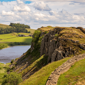
Combines incredible history with challenging countryside and unforgettable views. From sweeping vistas across Northumberland National Park to iconic sections of Hadrian's Wall, this route offers one of the UK's most rewarding walking experiences for adventurous dogs and owners.

What to expect: Historic Roman landmarks, dramatic ridgeline views and some of the most photographed scenery on Hadrian's Wall.

Region:
North East England
Location:
Hadrian's Wall, Northumberland
Postcode:
NE47 7AN
Coordinates:
55.003042, -2.390831  

Start / End Point:
Steel Rigg Car Park
Distance:
4.5 miles

Duration:
Around. 2-3 hours
Difficulty:
Moderate

Accessibility:
This route is not suitable for wheelchair and pushchair users due to steep climbs and descents, uneven and rocky paths, exposed ridgelines, muddy sections after rainfall and steep drops above Crag Lough.

Parking:
Steel Rigg car park .

Fees / charges:
Parking charges may apply. Nearby visitor facilities and historic sites may charge separately, so check current tariffs before travelling.  

Facilities:

  • Public toilets nearby at The Sill National Landscape Discovery Centre
  • Café nearby; check individual dog-friendly policies before visiting
  • Visitor information nearby
  • Picnic areas nearby

Dog-Friendly Features:

  • Open countryside
  • Historic landmarks
  • Varied terrain
  • Panoramic views
  • Wid-open walking
  • Natural scent trails

Dog guidance: Dogs are welcome throughout the route and should be kept under close control at all times. Use a lead around livestock, grazing land, cattle, steep drops, cliff edges, Crag Lough, historic structures and wherever local signage asks for it.  

Suggested Route:

  1. Start at Steel Rigg View Car Park.
  2. Leave the car park through the wicket gate in the corner, signposted Hadrian's Wall.
  3. Follow the footpath straight ahead until you meet hadrian's Wall.
  4. Turn left through the gate and follow the Wall down the grassy bank.
  5. At the paved footpath, turn left and climb steeply to the top of Peel Crags.
  6. Continue alongside Hadrian's Wall towards Milecastle 39.
  7. Continue towards Sycamore Gap, taking care on the undulating path.
  8. Follow the path above Grag Lough, staying well back from steep drops.
  9. Continue through the wood and pass through the gate.
  10. Cross the farm track and follow the paved path through the gate signed Housesteads.
  11. Continue on the grassy path towards Hotbank Farm.
  12. Follow the route as it loops back towards Steel Rigg.
  13. Return to Steel Rigg Car Park.

Things to be mindful of:

  • Steep climbs and descents
  • Livestock including sheep and cattle
  • Exposed upland weather conditions
  • Muddy and slippery sections after rainfall
  • High winds on exposed ridgelines
  • Steep drops above Crag Lough
  • Limited shelter along the route

What to pack:
Pack water for you and your dog, a collapsible bowl, dog waste bags, snacks and treats, a towel for muddy paws, weather-appropriate layers, sturdy footwear and a lead suitable for livestock, wildlife and busy sections.

Countryside Code reminder:
Follow local signs, keep dogs on lead around livestock, steep drops and historic structures, stay on marked paths, leave gates as found, clean up after your dog and be prepared for fast-changing upland weather.

 
Newborough
14

Newborough Forest & Llanddwyn Circular

Anglesey, Wales

Few routes offer such diversity, combining woodland, coastline and iconic Welsh scenery in a single walk. The combination of Newborough Forest, vast sandy beaches and the magical setting of Llanddwyn Island makes this one of the most spectacular dog walking destinations in the UK.

What to expect: Forest trails, sand dunes, beaches and stunning island views.

Region:
Wales
Location:
Anglesey
Postcode:
LL51 6SG
Coordinates:
53.142600, -4.385000  

Start / End Point:
Newborough Beach Car Park  
Distance:
5 miles

Duration:
Around. 3 hours
Difficulty:
Easy-Moderate

Accessibility:
This route is partially accessible for wheelchair and pushchair users, with forest tracks, sandy paths, dunes, beach sections and uneven terrain on Llanddwyn Island; some sections can be challenging for wheelchair users and visitors with limited mobility, particularly during wet conditions or high tides.

Parking:
Newborough Beach car park.  

Fees / charges:
Parking charges may apply at Newborough Beach car park. Check current parking tariffs, seasonal restrictions and any managed-site notices before travelling.  

Facilities:

  • Public toilets
  • Water refill points
  • Picnic areas
  • Visitor information
  • Beach access
  • Forestry and nature reserve facilities nearby; dog access may vary, so check site rules before visiting

Dog-Friendly Features:

  • Woodland trails
  • Beach access
  • Open Dunes
  • Water access
  • Island exploration
  • Exceptional scent and enrichment opportunities
  • Large areas of open space for walking

Dog guidance: Dogs are welcome throughout the route and should be kept under close control at all times. Use a lead around livestock, nesting birds, dunes, wildlife-sensitive areas, Llanddwyn Island, busy beach sections and wherever local signage asks for it, particularly during seasonal restriction periods.  

Suggested Route:

  1. Star at Newborough Beach car park.
  2. Follow signs for the Sain, Sand and Sea Trail or the main route towards Llanddwyn.
  3. Walk through the pine forest towards the beach and dunes.
  4. Emerge near the beach and continue towards Llanddwyn Island.
  5. Check tide conditions before acessing Llanddwyn Island.
  6. Follow the island paths towards the reuins of St Dwynwen's Church.
  7. Continue towards the lighhouses, including Twr Mawr and Twr Bach.
  8. Loop around the island paths, taking care on rock and shell paths.
  9. Return from the island to the beach and forest edge.
  10. Follow the forst route back through Newborough Forest.
  11. Return to Newborough Beach car park.

Things to be mindful of:

  • Check tide times before accessing Llanddwyn Island
  • Soft sand can be tiring for both dogs and owners
  • Seasonal wildlife and nesting bird restrictions
  • Exposed coastal conditions and strong winds
  • Uneven rocky sections around the island
  • Limited shade once on the beach and island sectionst

What to pack:
Pack water for you and your dog, a collapsible bowl, dog waste bags, snacks and treats, a towel for muddy paws, weather-appropriate layers, sturdy footwear and a lead suitable for livestock, wildlife and busy sections.

Countryside Code reminder:
Follow local signs, keep dogs under close control around livestock, wildlife, roads and steep drops, leave gates as found, clean up after your dog and stay on marked paths to protect habitats.

what3words ref: majoring.character.mimics

 
Wells Cathedral
15

Wells Cathedral & Bishop's Palace Circular

South West England, Wells, Somerset

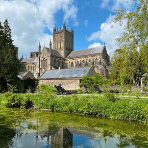
A charming city walk that proves great dog walking experiences aren't limited to the countryside. Combining medieval streets, beautiful green spaces, iconic architecture and plenty of dog-friendly stops along the way, Wells offers a relaxed and unique walking experience for both dogs and owners.

What to expect: Historic streets, green spaces, waterways and architectural landmarks.

Region:
South West England
Location:
Wells, Somerset
Postcode:
BA5 2UE
Coordinates:
51.210300, -2.643500  

Start / End Point:
 Wells Cathedral Green  
Distance:
1-2 miles

Duration:
Around. 1 hour
Difficulty:
Easy

Accessibility:
This route is fully accessible for wheelchair and pushchair users, following largely level pavements, pedestrianised streets, Cathedral Green and well-maintained pathways around the Bishop's Palace grounds, making it one of the most accessible walks on the list.  

Parking:
Wells city centre car parks, including nearby long-stay and short-stay public parking within walking distance of Cathedral Green.  

Fees / charges:
City-centre parking charges may apply. Wells Cathedral and The Bishop’s Palace may charge separate admission for visitor entry, tours or gardens, so check current prices before visiting.  

Facilities:

  • Public toilets
  • Cafés nearby; check individual dog-friendly policies before visiting
  • Restaurants and pubs nearby; check individual dog-friendly policies before visiting
  • Shops nearby; dog access may vary, so check individual policies before visiting
  • Visitor information
  • Historic attractions; dog access may vary, so check attraction rules before visiting
  • Public seating areas

Dog-Friendly Features:

  • Public toilets
  • Cafés nearby; check individual dog-friendly policies before visiting
    • Restaurants nearby; check individual dog-friendly policies before visiting
  • Elevated viewpoints
  • Diverse scents and terrain
  • Shaded woodland sections

Dog guidance: 

Dogs are welcome on the outdoor route and should be kept under close control at all times. Use a lead around roads, pedestrian areas, visitor attractions, water features, crowds and wherever local or attraction-specific signage asks for it.

Suggested Route:

  1. Start at Cathedral Green.
  2. Walk towards Wells Cathedral, taking in the impressive west front.
  3. Cross the Green towards the Market Place.
  4. Go thrugh Bishop's Eye, the gateway leading towards the Bishop's Palace moat.
  5. Follow the path alongside the moat.
  6. Continue around the moat path towards the southern corner.
  7. Retrace your route back towards Bishop's Eye.
  8. Turn back into Market Place.
  9. Pass through Penniless Porch onto Cathedral Green.
  10. Walk north across Cathedral Green and continue towards Vicar's Close.
  11. Walk into Vicar's Close, often described as one of the oldest continuously inhabited residential streets in Europe.
  12. Return the same way towards Cathedral Green.
  13. Finish back at Wells Cathedral Green.

Things to be mindful of:

  • Busy pedestrian areas during peak visitor seasons
  • Road crossings in the town centre
  • Cyclists and other path users
  • Water alongside sections of the Bishop's Palace moat
  • Events and markets that can increase footfall
  • Warm weather due to limited shade in some open areas

What to pack:
Pack water for you and your dog, a collapsible bowl, dog waste bags, snacks and treats, a towel for muddy paws, weather-appropriate layers, sturdy footwear and a lead suitable for livestock, wildlife and busy sections.

Countryside Code reminder:
Follow local signs and attraction rules, keep dogs on lead around roads, crowds and water features, clean up after your dog and give other visitors plenty of space.  

what3words ref: shifts.confident.kettles

 
Wallington River
16

Wallington River Walk

North East England, Northumberland

 A relaxed countryside walk that blends nature, heritage and plenty of space to roam. Combining woodland, riverside scenery and some of Northumberland's most picturesque estate landscapes, it offers a peaceful and varied experience for both dogs and owners.

What to expect: Woodland paths, riverside sections and beautiful estate scenery.

Region:
North East England
Location:
Northumberland
Postcode:
NE61 4AR
Coordinates:
55.152201, -1.956351  

Start / End Point:
Wallington Estate Main Car Park  
Distance:
4 miles

Duration:
Around. 1.5-2 hours
Difficulty:
Easy-Moderate

Accessibility:
This route is partially accessible for wheelchair and pushchair users, with a relatively gentle route overall but a mix of surfaced and natural paths, uneven sections, occasional gradients and river areas that may become muddy after rainfall.  

Parking:
Wallington Estate Main car park.  

Fees / charges:
National Trust parking or admission charges may apply at Wallington; National Trust members may have free or reduced access where valid. Check current entry and parking details before travelling.  

Facilities:

  • Public toilets
  • Cafés nearby; check individual dog-friendly policies before visiting
  • Visitor centre; dog access to indoor areas may vary, so check site rules before visiting
  • Gift shop; dog access to indoor areas may vary, so check site rules before visiting
  • Picnic areas
  • National Trust facilities; dog access may vary, so check site rules before visiting
  • Water refill points

Dog-Friendly Features:

  • Riverside walking
  • Woodland trails
  • Open estate grounds
  • Elevated viewpoints
  • Abundant scent and enrichment opportunities
  • Shaded sections in warmer weather
  • Long stretches away from roads

Dog guidance: Dogs are welcome throughout the route and should be kept under close control at all times. Use a lead around livestock, wildlife, gardens, the river, stepping stones, busy estate areas and wherever estate signage asks for it.  

Suggested Route:

  1. Start in Wallington Courtyard with the clocktower behind you.
  2. Head to the gateway in the left-hand corner.
  3. Pass through the gateway, turn left onto East Drive and head away from the house.
  4. Cross the road carefully and enter East Wood.
  5. Head down Serpentine Walk towards Garden Pond.
  6. Follow the path around Garden Pond and enter the walled garden through Neptune Gate.
  7. Continue through the garden route and exit through the far doorway.
  8. Continue towards the riverside section of the walk.
  9. Follow the route along the River Wansbeck, using bridges and stepping stones where open.
  10. Continue through woodland and riverside paths.
  11. Follow signs back towards the estate buildings and return to Wallington Courtyard / Main Car Park.

Things to be mindful of:

  • River Wansbeck water levels
  • Muddey sections following rainfall
  • Stepping stones may be closed or submerged
  • Livestock and wildlife on the estate
  • Uneven woodland terrain
  • Shared use with walkers and families

What to pack:
Pack water for you and your dog, a collapsible bowl, dog waste bags, snacks and treats, a towel for muddy paws, weather-appropriate layers, sturdy footwear and a lead suitable for livestock, wildlife and busy sections.

Countryside Code reminder:
Follow estate signage, keep dogs on lead around livestock, wildlife, gardens and other visitors, leave gates as found, clean up after your dog and avoid entering water when river levels are high. .

what3words ref: confident.rooster.leader

 
Box Hill
17

Box Hill Circular

South East England, Surrey Hills

A varied route showcasing the very best of the Surrey Hills National Landscape. Combining woodland, open countryside, riverside scenery and far-reaching views across southern England, Box Hill offers a classic countryside adventure packed into a manageable circular route.

What to expect: Woodland paths, chalk grassland and panoramic countryside views.

Region:
South East England
Location:
Surrey Hills
Postcode:
RH5 6BX
Coordinates:
51.249174, -0.313207  

Start / End Point:
National Trust Box Hill Visitor Centre
Distance:
4 miles

Duration:
Around. 2 hours
Difficulty:
Moderate

Accessibility:
This route is not suitable for wheelchair and pushchair users due to steep ascents and descents, uneven woodland paths, steps, chalk surfaces and the Stepping Stones crossing area.  

Parking:
National Trust Box Hill Visitor Centre car park.  

Fees / charges:
National Trust parking charges apply for non-members; National Trust members may park free where valid. Check current tariffs and payment options before travelling.  

Facilities:

  • Public toilets
  • Cafés nearby; check individual dog-friendly policies before visiting
  • Visitor centre; dog access to indoor areas may vary, so check site rules before visiting
  • National Trust shop; dog access to indoor areas may vary, so check site rules before visiting
  • Picnic areas
  • Visitor information point
  • Water refill points

Dog-Friendly Features:

  • Woodland trails
  • Open chalk grassland
  • Panoramic viewpoints
  • River access nearby
  • Natural scent trails
  • Diverse terrain

Dog guidance: Dogs are welcome throughout the route and should be kept under close control at all times. Use a lead around livestock, grazing areas, steep slopes, steps, the River Mole crossing, busy visitor sections and wherever National Trust or local signage asks for it.  

Suggested Route:

  1. Start at the National Trust Visitor Centre at the top of Box Hill.
  2. Follow the surfaced path away from the visitor centre.
  3. Ignore the track to the right and continue along the surfaced path parallel to the road.
  4. Continue until the view opens out of Salomons Memorial.
  5. From the viewpoint, walk down and the sloped path below the memorial.
  6. Turn right and continue along the path.
  7. Follow the route downhill towards the River Mole.
  8. Descend carefully using the steps and steep path sections.
  9. Cross the river using either the stepping stones or the bridge if preferred or safer.
  10. Follow the path onwards and begin the ascent back towards Box Hill.
  11. Continue on the marked route through woodland and chalk grassland.
  12. Follow signs back towards the summit and visitor centre.
  13. Finish back at the National Trust Visitor Centre.

Things to be mindful of:

  • Steep sections and long staircaes
  • Slippery paths after rain
  • Livestock grazing on surrounding hillsides
  • Uneven chalk surfaces
  • Busy visitor numbers during weekends and holidays
  • Heat exposure in open grassland during summer
  • River crossings and steep drops in some areas

What to pack:
Pack water for you and your dog, a collapsible bowl, dog waste bags, snacks and treats, a towel for muddy paws, weather-appropriate layers, sturdy footwear and a lead suitable for livestock, wildlife and busy sections.

Countryside Code reminder:
Follow National Trust signage, keep dogs under close control around grazing animals, steep slopes, steps and other visitors, clean up after your dog and stay on marked paths to protect chalk grassland.

what3words ref: model.mild.burst

 
Giant's
18

Giant's Causeway Blue Trail

County Antrim, Northern Ireland

A unique walking experience where spectacular geology and coastal scenery create an unforgettable outing for dogs and owners alike. Few places in the UK offer such a distinctive landscape, with the world-famous basalt columns providing a truly memorable backdrop for a walk.

What to expect: Dramatic coastline, basalt columns and one of the UK's most iconic natural landmarks.

Region:
Northern Ireland
Location:
County Antrim, Northern Ireland
Postcode:
BT57 8SU
Coordinates:
55.233007, -6.516711  

Start / End Point:
Giant's Causeway Visitor Centre
Distance:
0.8 miles

Duration:
Around. 30 minutes
Difficulty:
Easy

Accessibility:
This route is partially accessible for wheelchair and pushchair users, with the Blue Trail following a surfaced path from the Visitor Centre to the Causeway stones, although steep gradients and the uneven basalt stones may be challenging for some visitors.  

Parking:
Giant's Causeway Visitor Centre car park

Fees / charges:
Pedestrian access to the Causeway stones is free, but the National Trust Visitor Experience, on-site parking, visitor facilities and shuttle services may involve charges. Pre-booking may be required, so check current options before visiting.

Facilities:

  • Public toilets
  • Visitor centre; dog access to indoor areas may vary, so check site rules before visiting
  • Cafés nearby; check individual dog-friendly policies before visiting
  • Gift shop; dog access to indoor areas may vary, so check site rules before visiting
  • Visitor information
  • Picnic areas nearby
  • Shuttle bus service (seasonal); check whether dogs are permitted before travelling

Dog-Friendly Features:

  • Coastal scenery
  • Open-airwalking
  • Unique rock formations
  • Natural exploration opportunities
  • Sea views
  • Short, manageable route suitable for most dogs

Dog guidance: Dogs are welcome throughout the route and should be kept under close control at all times. Use a lead around the Visitor Centre, basalt stones, steep coastal sections, busy areas, shuttle bus route and wherever site signage asks for it.  

Suggested Route:

  1. Start at Giant's Causeway Visitor Centre.
  2. Follow signs for the Blue Trail.
  3. Descend along the formal path towards the Causeway stones.
  4. Stay on the pedestrian path, particularly when the site shuttle bus is operating.
  5. Continue towards the main Causeway area.
  6. Explore the basalt columns carefully, taking care as the stones can be come slippery when wet.
  7. Continue towards the Giant's Boot at the far end of the formation.
  8. Take time to enjoy the coastal views and distinctive geological formations.
  9. Retrace your steps along the Blue Trail back towards the Visitor Centre, or use the shuttle bus if operating and preferred.
  10. Finish at Giants's Causeway Visitor Centre.

Things to be mindful of:

  • Slippery basalt stones, especially after rain
  • Steep sections on the approach path
  • Strong coastal winds
  • Busy visitor numbers during peak periods
  • Exposed viewpoints
  • Uneven surfaces on the Causeway itself
  • Limited shelter in poor weather conditions

What to pack:
Pack water for you and your dog, a collapsible bowl, dog waste bags, snacks and treats, a towel for muddy paws, weather-appropriate layers, sturdy footwear and a lead suitable for livestock, wildlife and busy sections.

Countryside Code reminder:
Follow site signage, keep dogs on lead around the Visitor Centre, basalt stones, steep coastal sections and busy areas, clean up after your dog and give wildlife and other visitors plenty of space.

what3words ref: moral.carefully.corded

 
Tollymore River
19

Tollymore River Trail

County Down, Northern Ireland

Offers an immersive woodland adventure beneath the Mourne Mountains. Combining ancient forest, dramatic river scenery, historic stone bridges and some of Northern Ireland's most beautiful natural landscapes, it provides a varied and rewarding walking experience for both dogs and owners.

What to expect: Forest trails, riverside paths, stone bridges and mountain backdrops.

Region:
Northern Ireland
Location:
County Down, Northern Ireland
Postcode:
BT33 0PW
Coordinates:
 54.224533, -5.940282  

Start / End Point:
Tollymore Forest Park Main Car Park
Distance:
3.3 miles

Duration:
Around. 1.5-2 hours
Difficulty:
Moderate

Accessibility:
This route is not suitable for wheelchair and pushchair users due to natural forest paths, steps, tree roots, uneven surfaces, moderate gradients, narrow sections and riverside terrain.

Parking:
Tollymore Forest Park main car park.

Fees / charges:
Forest recreation / vehicle entry charges may apply at Tollymore Forest Park. Check current daily charges, camping fees and any activity charges before travelling. .

Facilities:

  • Public toilets
  • Picnic areas
  • Visitor information
  • Café nearby; check individual dog-friendly policies before visiting
  • Camping and caravan facilities; dog access may vary, so check site rules before booking or visiting
  • Waymarked trails
  • Information kiosk

Dog-Friendly Features:

  • Woodland trails
  • Riverside walking
  • Streams and waterfall features
  • Natural scent trails
  • Open forest space
  • Mountain scenery
  • Long off-road walking sections

Dog guidance: Dogs are welcome throughout the trail and should be kept under close control at all times. Use a lead around the river, bridges, wildlife, picnic areas, busy woodland sections, forestry work areas and wherever forest signage asks for it.

Suggested Route:

  1. Start from Tollymore Forest Park main car park.
  2. Follow the red waymarker arrows for the River Trail.
  3. Descend via the Azalea Walk towards the Shimna River.
  4. Follow the trail upstream along the tree-lined riverbank.
  5. Continue past the Hermitage, one of the route's most recognisable landmarks.
  6. Cross the river at Parnell's Bridge.
  7. Continue along the route, stopping to admire views of the Pot of Legawherry.
  8. Take the optional spur to White Fort Cashel if desired.
  9. Follow the Spinkwee River downstream through woodland sections.
  10. Continue past the cascades and back towards the Meeting of the Waters.
  11. Follow the route through conifer plantations and past the duck pond.
  12. Cross the Shimna River via the Old Bridge.
  13. Follow the final section through Green Rig.
  14. Return to Tollymore Forest Park main car park and finish where you began.

Things to be mindful of:

  • Tree roots and uneven ground
  • Slippery paths after rainfall
  • Riverside sections and fast-moving water
  • Steps and moderate gradients
  • Working forest operations at certain times
  • Fallen branches and natural forest hazards
  • Seasonal route diversions where forestry work is taking place

What to pack:
Pack water for you and your dog, a collapsible bowl, dog waste bags, snacks and treats, a towel for muddy paws, weather-appropriate layers, sturdy footwear and a lead suitable for livestock, wildlife and busy sections.

Countryside Code reminder:
Follow forest signage, keep dogs under close control around fast-moving water, wildlife and other visitors, clean up after your dog and stay clear of forestry work areas.  

what3words ref: send.patrolled.trailer

 
Tintern Abbey
20

Tintern Abbey & Devil's Pulpit Circular

Wye Valley, Monmouthshire

A route that combines natural beauty, history and some of the finest scenery in the Wye Valley. From the iconic ruins of Tintern Abbey to the breathtaking viewpoint at Devil's Pulpit, this walk delivers a rewarding mix of heritage, woodland exploration and panoramic views. 

What to expect: Riverside walking, ancient woodland, abbey views and elevated viewpoints.

Dog walk regions icon

Region:
Wales
Location:
Wye Valley, Monmouthshire
Postcode:
NP16 6SE
Coordinates:
51.702911, -2.671072

Dog walk start-end icon

Start / End Point:
Old Station Tintern
Distance:
5 miles

Duration:
Around. 3.5 hours
Difficulty:
Moderate

Accessibility:
This route is not suitable for wheelchair and pushchair users due to steep woodland climbs, uneven terrain, muddy sections after rainfall, field paths, gates and narrow woodland tracks; the Devil's Pulpit viewpoint is reached via challenging terrain and is not suitable for wheelchairs, pushchairs or visitors with limited mobility.

Parking:
Old Station Tintern car park.

Fees / charges:
Parking charges may apply. Tintern Abbey and other nearby historic attractions may charge separate entry fees, so check before visiting.

Facilities:

  • Public toilets
  • Cafés nearby; check individual dog-friendly policies before visiting
  • Restaurants and pubs nearby; check individual dog-friendly policies before visiting
  • Picnic areas nearby at Old Station Tintern
  • Visitor information nearby
  • Historic attractions including Tintern Abbey; dog access may vary, so check attraction rules before visiting

Dog-Friendly Features:

  • Woodland trails
  • Riverside walking
  • Open countryside
  • Elevated viewpoints
  • Diverse scents and terrain
  • Shaded woodland sections

Dog guidance: Dogs are welcome throughout the route and should be kept under close control at all times. Use a lead around livestock, wildlife, road crossings, steep woodland sections, exposed viewpoints, Devil’s Pulpit and wherever local signage asks for it.

Suggested Route:

  1. Start from the Tintern area and head towards Tintern Abbey.
  2. From the Abbey area, head to the bridge and cross to the opposite side of the River Wye.
  3. After crossing, follow the riverside path briefly, then look for the left turn climbing uphill.
  4. Take the steep path up through the woodland.
  5. Keep left as the path forks and continue climbing.
  6. Continue until the path reaches a track or road.
  7. Turn right up the track, then look for a right-hand footpath into fields.
  8. Forllow the path uphill through the fields towards the farm and lane section.
  9. Continue onto Mrs Grace's Lane.
  10. Follow the land until reaching the main road.
  11. Turn right briefly, then look for a right turn back onto a quieter track.
  12. At Devil's Pulpit, stop for views down towards Tintern Abbey.
  13. Continue along the woodland path, looking for the left turn descending steeply.
  14. Follow the descending path back towards the lower riverside and former railway path.
  15. Rejoin the approach route and return towards Tintern and old Station Tintern.
  16. Finish where you began at Old Station Tintern.

Things to be mindful of:

  • Steep ascents and descents
  • Muddey woodland paths after rain
  • Livestock in surrounding fields
  • Road crossings
  • Exposed viewpoints
  • Uneven and potentially slippery terrain
  • Navigation can be more challenging than some of the other routes on the list

What to pack:
Pack water for you and your dog, a collapsible bowl, dog waste bags, snacks and treats, a towel for muddy paws, weather-appropriate layers, sturdy footwear and a lead suitable for livestock, wildlife and busy sections.

Countryside Code reminder:
Follow local signs, keep dogs under close control around livestock, wildlife, roads and steep drops, leave gates as found, clean up after your dog and stay on marked paths to protect habitats.

what3words ref:  prelude.warbler.salaried  


*Methodology: The research was conducted by OnePoll, among a sample of 1,800 dog owners in UK (aged 18+). The data was collected between 6th and 13th July 2026. OnePoll is a Market Research Society (MRS) company partner, corporate members of ESOMAR and the British Polling Council (BPC).